The Karst Topography of the Eastern Adriatic
The eastern rim of the Adriatic Sea represents one of the world's most pronounced examples of drowned karst topography. Unlike the uniform low-lying sand bars characteristic of the western Italian Adriatic, Croatia's coastline is framed by the abrupt descent of the Dinaric Alps into the sea. This geological movement submerged river valleys and mountain ranges, producing over 1,200 islands, islets, and reefs running parallel to the mainland coast.
Karst formations are formed from soluble carbonate rocks such as limestone and dolomite. Millions of years of natural dissolution have carved underwater caverns, steep coastal cliffs, and subterranean freshwater springs known locally as vrulje. These freshwater springs emerge along the seabed, cooling coastal waters and contributing to the vivid clarity and emerald tint typical of Dalmatian bays.
Beaches, Shingle Bays, and Flat Limestone Slabs
Prospective travellers to Croatia should understand that pure sandy stretches are relatively rare across the Adriatic. Instead, the typical coastal profile comprises:
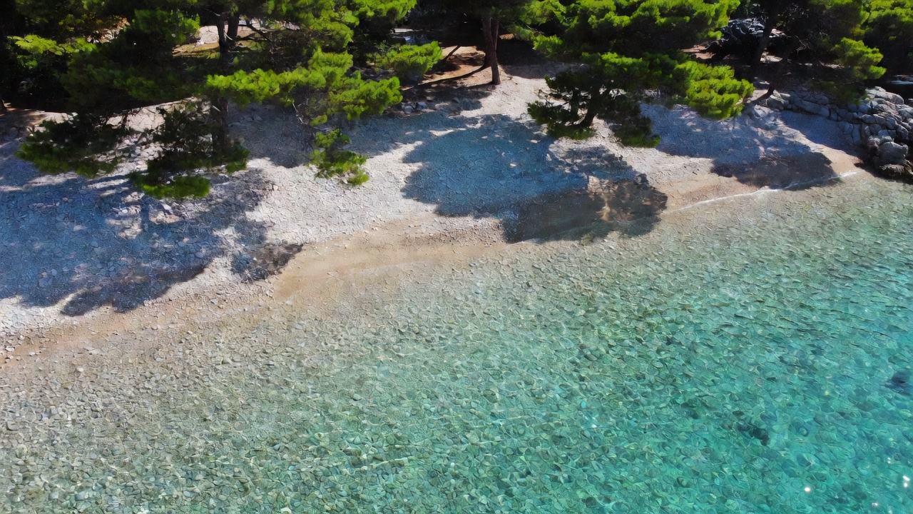
- Polished White Pebble Coves: Formed by limestone eroded from sheer cliffs and smoothed by tidal wash. Locations such as the Makarska Riviera and the southern shores of Brač feature fine shingle shores shaded by Aleppo pines.
- Natural Limestone Slabs: Natural flat rock plateaus worn smooth by maritime currents, offering private sunbathing ledges and deep-water plunge points directly into the sea.
- Enclosed Karst Inlets: Narrow marine canyons, such as Stiniva Bay on Vis Island, protected by high limestone gates that require navigation by foot down steep goat tracks or by sea kayak.
Regional Marine Climate & Winds
The Adriatic marine corridor is shaped by two predominant wind patterns: the Bora and the Jugo. The Bora is a catabatic, cold, and gusty north-easterly wind that descends from the coastal mountain passes (notably near the Velebit channel and Senj). While it quickly clears humidity and delivers crystal-clear skies, it can generate sudden coastal squalls. The Jugo, conversely, is a warm, humid south-easterly wind that brings ocean swell and cloud cover.
Navigating between the inner archipelago channels affords substantial protection from open-sea swells, making Dalmatia one of Europe’s premier maritime sailing regions.
Key Advantages
- Exceptionally clean waters with numerous Blue Flag accreditations.
- Calm inner waters protected by multiple layers of barrier islands.
- Extensive waterfront Venetian heritage and stone harbour towns.
- Aleppo pine forests often extend to the water's edge, providing natural shade.
Travel Considerations
- Sandy beaches are scarce; beach shoes are practically mandatory on pebbles and rocks.
- Sea urchins are present in rocky shallows, requiring careful entry.
- Coastal highway traffic can bottleneck during July and August.
Logistics & Regional Travel Advice
Croatia’s coastal transit network is anchored by state-operated car ferry operator Jadrolinija, complemented by private catamaran routes connecting Split, Zadar, and Dubrovnik to outer islands such as Hvar, Korčula, and Vis. While booking foot-passenger catamaran tickets online in advance is essential during peak summer, vehicle ferries maintain continuous rolling services along key crossings.